Severe Storms Expected For The Region This Afternoon 5/15
Get Ready for very springlike weather. Sunshine and rising temperatures the past few days have given the Northeast a desperately needed reprieve from the chilly and dreary weather that pestered the region during much of April into May -- with some locations even getting the latest snowfall ever recorded.
Even though the polar vortex will retreat and winterlike cold is not expected to return, unsettled weather will dampen the region and keep it cooler than normal much of next week.
The soggier stretch will kick off with a bang on today as severe thunderstorms will threaten portions of the Northeast.
AccuWeather Senior Meteorologist Joe Lundberg said.
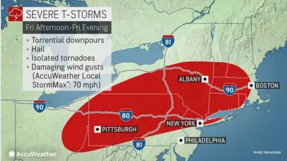
Thunderstorms will erupt Friday afternoon ahead of a cold front across parts of Ohio, northwestern Pennsylvania and upstate New York then charge east and southeastward into portions of New England, the lower Hudson Valley and central and eastern Pennsylvania into the early evening hours.
There is an Enhanced Risk for severe thunderstorms this afternoon into early this evening. The main threats will be damaging winds of 58 mph or greater and heavy rainfall. Large hail, one inch in diameter or larger, and an isolated tornado are also possible.
Some poor drainage flooding of low lying areas and ponding of water
on roadways is possible with any thunderstorms.
More From WBEC AM